Baja driving directions to DownWinder Inn
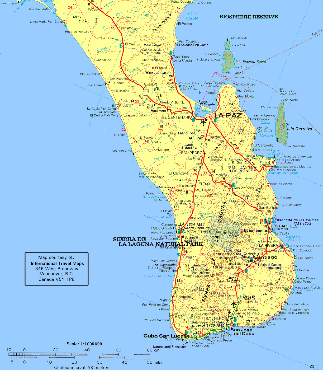
Driving Directions From San Jose Del Cabo Airport:
- Exit the airport heading east for 1/2 mile to the main highway, then turn NORTH, left at the highway towards Los Barriles and San Bartolo.
- Once in San Antonio (disregard the sign indicating San Antonio to your left, the actual town of San Antonio is a couple of miles later, and the highway I is crossing it), you’ll go pass a river bed, and past the Pemex station, as you start to go uphill in a left curve filled with big palm trees, turn right off the highway into the village. It’s a freshly paved road as well and there will be a sign indicating La Ventana / San Juan de Los Planes. This road will take you in 20 minutes to Los Planes (Highway 286).
- Turn left when you get to Highway 286 (direction La Paz), drive past the next Pemex gas station, and turn right at the first paved road past the Pemex station towards La Ventana – El Sargento.
- Once the paved road ends, the road makes a sharp left, then a sharp right you will be seeing the bay on your right. Go another mile and past the large dip in the road look for the DownwinderInn sign, turn left at the 2nd sign, go 100 feet and turn left, your here!
- Also found on Maps & Google Maps


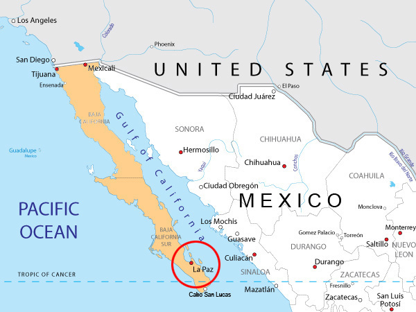
Driving Directions From La Paz:
- If driving from La Paz, simply follow highway 1 from La Paz South to Highway 286 (intersection south of Dorian’s mall).
- Take a left and travel southeast towards San Juan de Los Planes.
- Once over the mountains, look for Km 36 and turn left towards El Sargento & La Ventana. La Ventana is about 7km.
- Once the paved road ends, soon the road makes a sharp left, then a sharp right you will be seeing the bay on your right.
- Go another mile and just past the large dip in the road look for DownwinderInn sign on the left, turn, and take your next left, your here!
Major airlines no longer fly to La Paz. Drive from Cabo to La Ventana is only 2 hours.

Hot Springs, North of Town or 1/2 mile away


